Wednesday 30 December 2020

Dumbarton. River Leven. Right Hand Walkway Route.

                                                   ALL PHOTOS CLICK FULL SCREEN.


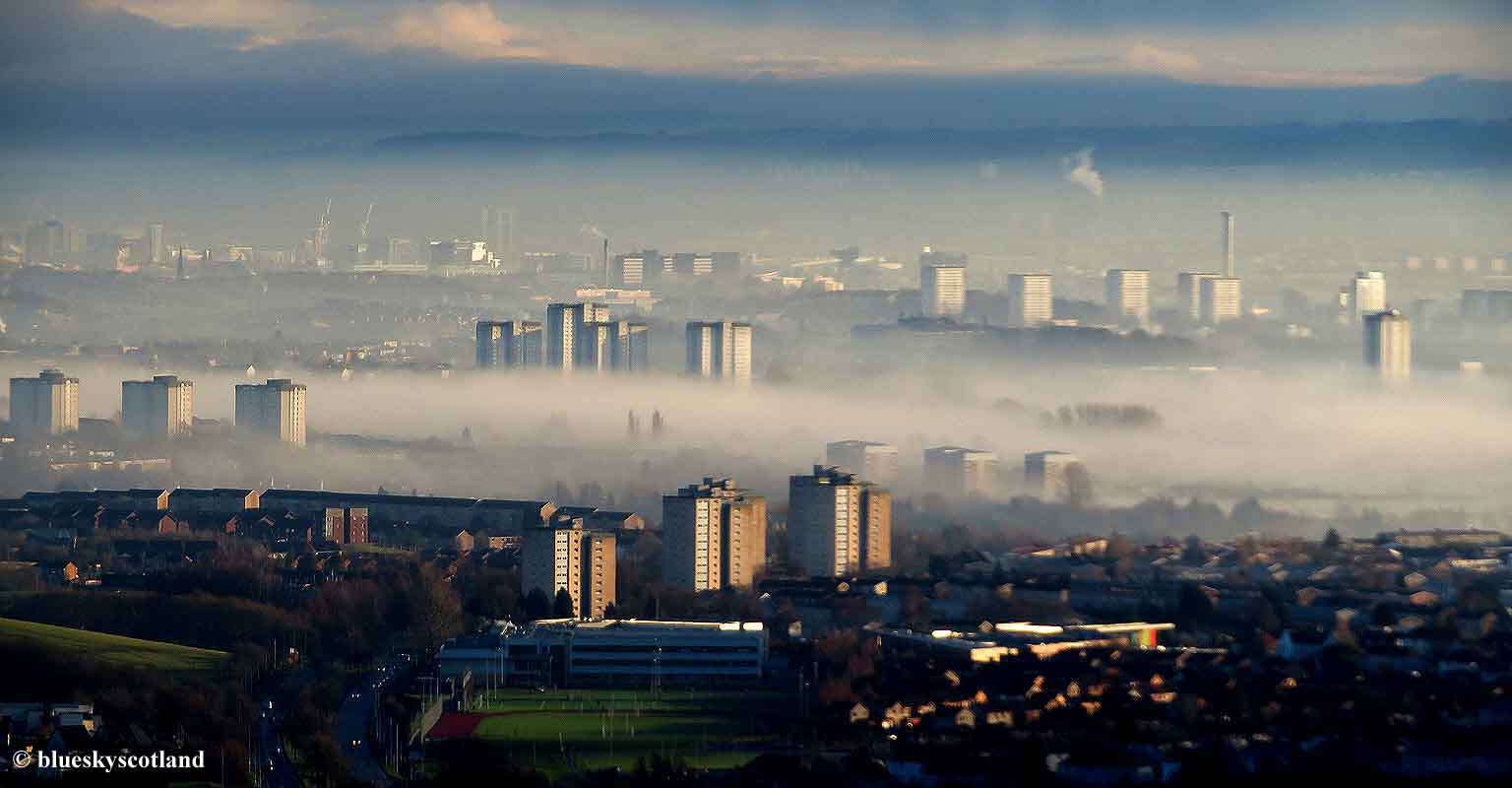
A few weeks ago I decided to do another walk in Dumbarton I'd found on the Glasgow AZ map/ book. A thin dotted line ran up the right hand bank of the River Leven and as it was a completely new walk for me, a rare event in itself,  I fancied a go at it. River Leven at Dumbarton, above. It was another grey December misty morning so I began to doubt my choice of destination and wondered if I'd see anything at all as I was walking up a river system, not climbing a hill to rise above the mist level.

It turned out fine though and the mist hanging over the river only added to the atmosphere, like black and white period films of the notorious London Fog. The thickest mist/fog bank seemed to be out in the main River Clyde Estuary channel again so maybe by heading inland I'd have better luck.

Winter trees. As it was fairly thick to begin with I went a walk in the nearby park first just to see if good mist effects were occurring there and by the time I returned to the town the morning mist was starting to clear up inland.

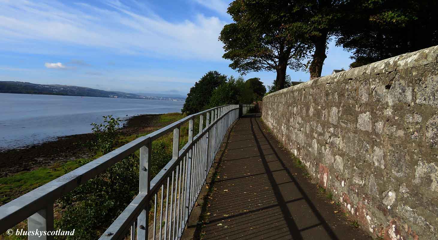
 A weak sun even appeared. The normal cycling/walking path is up the left hand bank of the river. The right hand bank is much quieter, slightly wilder in places, but also runs past a couple of industrial estates so it's a mixed bag of experiences.

The path starts off in Dumbarton once over the main road bridge near Dalreoch Train Station, good at first on tarmac/concrete slabs then narrows down to a grass strip beside the river. Easy to follow on foot it soon gets twisty and very narrow in places, winding between thorn bushes at times so not suitable for bikes further on as it would be tedious and time consuming instead of enjoyable. So narrow at one point I was hanging onto a fence to avoid the swollen river below.


 No problem on foot though. This is passing the industrial estate.


Passing the area known as the Leven Swamp, looking back towards Dumbarton. The Leven Swamp is basically the flood mashes of the river on both sides as the Leven is the only outlet for the 23 mile long Loch Lomond and surrounding mountains/streams so has to empty a vast area quickly during wet weather and often bursts its banks here, spreading out further at this point in winter. Currents in spate conditions can be deep and powerful in the main channel so if you fell in you might end up in Greenock quicker than you would like. It's a very fast river at times and you would not stand much of a chance once in its grip.


Although the Leven is a fairly short river it is an impressive one and seals and other sea life have been known to frequent these brackish margins, even venturing upstream at full high tide to negotiate the various small rapids into the freshwater loch itself, as did the Vikings on raiding parties.This gave them boat access to a large fertile area inland. Robert the Bruce, King of Scots, retired here, his last few years spent in a mansion house on the banks near Renton, hunting ducks and fishing when he felt well enough to venture out.


The Leven Swamp, looking upstream.


The icy slopes of Ben Lomond seen across the river. Very few other walkers on this secluded path.


 The path also skirts the town golf course at one point, thick with overnight frost at minus 4 degrees.


Another view of it here with the Lang Craigs looming behind.


Further on the narrow path climbs to a high trail above the river then runs through woods. You can either continue on into Alexandria and then return down the left hand bank via a town bridge or, as I did, return through the Strathleven Trading estate, which is more scenic and green than the name suggests on good pavements and other tarmac ribbons as it used to be a large formal estate in the old style of the name.


Strathleven House, once a grand mansion surrounded by its own private grounds but now an HQ with local offices within the trading estate.


Further down you pass Andy Scott's magnificent stag at Lomondgate as you enter Dumbarton again.

Another view of it from the sunlit side. The base it stands on is just as interesting as the stag itself. Similar to a water reflection, but cast in metal.


Dumbarton's Bellsmyre Housing estate with the cliffs of the Lang Craigs behind. The weathered remains of an ancient lava flow.


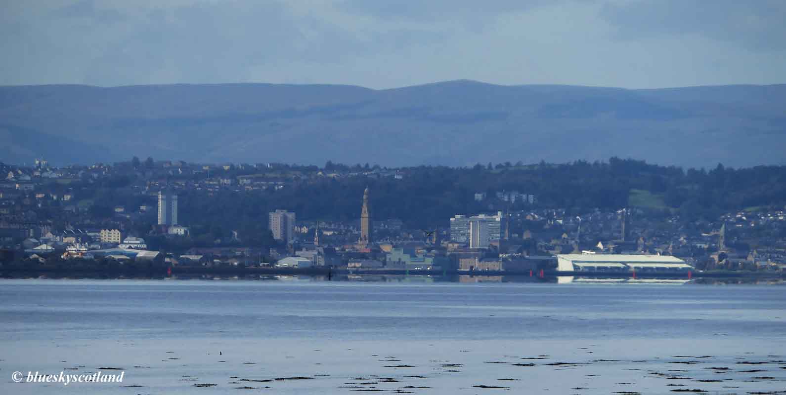
Dumbarton at one time was famous for its shipbuilding, its whisky distilleries, and its glass ware but like most post industrial towns it's not as wealthy as it once was.


 But you can still see from its older buildings it did have money to spend  at one time. Braehead primary school here, solidly constructed to last for centuries.


Period tenements on Dumbarton's modest but interesting heritage trail. Built in 1906 going by the elaborate date carving on a wall.


The town's  municipal buildings and office HQ. A 1900 confection in old red sandstone, which is a local quarry stone found around the River Clyde Estuary offering feature buildings of great merit in many Scottish west coast towns and the City of Glasgow, famed for its old red sandstone Victorian and Edwardian street architecture, similar in style to this.


 The elephant and castle. Denoting strength and impregnable defenses. Throughout many centuries Dumbarton Rock and its fortress/castle, from the iron age on-wards, protected this stretch of coast from hostile forces. A hard nut to crack although the Vikings eventually managed it with siege tactics. The City of Coventry also has an elephant and castle as its coat of arms, plus wildcats with banded tails, and London of course has the most well known example at Southwark.


The statue of Peter Denny, one of a family of shipbuilding brothers he went on to dominate the sides of the River Leven at its deepest, where it ran into the larger River Clyde, building a string of famous ships in his yards to export around the world throughout the mid to late 1800s.


Late afternoon sunlight back in Dumbarton.


And a glorious December sunset over Renfrewshire to end.


A good easy walk of a few hours duration, longer if travelling on into Alexandria then back down the other side. Grass paths mainly on right bank. Not too much mud at present. Right hand route unsuitable on a bike due to narrow paths, twisting up and down nature and slow progress in places through undergrowth.


Tuesday 15 December 2020

The Magic Escarpment. Mist Inversion over Glasgow and Clydebank.

                                                      ALL PHOTOS CLICK FULL SCREEN.


On a few days each year, usually in November/ early December, the City of Glasgow gets a classic mist inversion as it sits in a bowl shaped hollow surrounded on three sides by hills. There are several places to see this effect. The Campsie Fells area around Mugdock and the Whangie, The Fintry Hills, The Brownside Braes and The Kilpatrick Hills. From decades of previous experience I usually know when this effect will occur so I picked a day a few weeks ago and headed for Old Kilpatrick. A decade ago this car park would seem busy with a dozen cars in it on a weekend but in 2020 finding 60 to70 cars crammed in here everyday is not unusual. As I was busy in the morning and it was a thick pea souper down in the Glasgow hollow I waited until lunchtime to set off, hoping to nab a precious parking space from folk that were coming back down off the hills. And this proved to be the case.

Although I started off in thick mist I was confident I would rise above it the higher I climbed and a few hundred feet higher this proved to be the case. These photos do not do justice to how good this day was in reality. A magical atmosphere and a cracking day out.

Judging from the mist levels I may have timed it just right with an afternoon ascent as The Erskine Bridge, seen here, was completely hidden at first. After an hour a gentle breeze picked up and various holes started to appear in the thick mist blanket below.

Another one of the Erskine Bridge appearing with the Renfrewshire ridges clear. You could easily tell where the River Clyde was in the landscape as that was where the mist lingered the longest, refusing to dissipate. Unlike the masses heading up the land rover track to the reservoirs I quickly headed east, back towards the city, traversing steep slopes high above Clydebank and Glasgow, moving in the direction of Duntocher.


 This used to be an easy walk but its much harder today as they have planted loads of young trees all over these hillsides with several vicious barbed wire fences to negotiate and an eight foot high deer fence, which did have a stile over it. As I have a painful shoulder injury at present this route was a real challenge for me as I was effectively one armed. Folk with a dog or a bike would find this walk very difficult if not impossible. On the plus side this faint path I was following is one of the very few that is still short green grass and not trashed into mud and bog through overuse. Indeed I never met anyone else on this walk the whole day. Very quiet route. Why? Most people hill walking want to bag summits. This is a hard to access balcony trail without any.


As I progressed further along the escarpment the mist started to lift over the city and Clydebank and Glasgow's numerous tower blocks began to appear. A wonderful sight. The tight cluster of Radnor Park Hi Rise flats on the right here, built after Clydebank was heavily bombed and many older buildings in this former shipyard town were flattened by the Germans during World War II.


One of the fog bound River Clyde with the 46 metre (150 foot high) Titan cantilever crane next to Clydebank College sticking up. The low lying and flood prone Newshot Island with the spires in the town of Renfrew just poking out are also visible.


The A82 dual carriageway heading past Clydebank at Drumry descending slowly past the tenements of Drumchapel down into Glasgow here in this one. Over the decades I've had many great adventures mountaineering, hill-walking and general exploring outdoors. As a hobby/ pastime/pleasure/ addiction it's the lifelong gift that keeps on giving and unlike some other pursuits where repetition dulls the senses this day out was up there with the very best. A joy to behold. As good as any view from Mount Olympus or a fallen angel plunging to earth with eyes wide open.


Berthed cruise ships at Govan docks, laid up here due to the pandemic with the new hi rise hospital behind.


Approaching Duntocher with the white water tower in Drumchapel visible, dead centre.

This photo shows how the mist can distort/hide things as for a moment I thought three massive cruise ships had arrived unannounced in Glasgow with the real three medium sized boats, sitting sideways, as mere elevated bridges on much larger boats. It's actually the sloping roof of Intu/ X-scape and other buildings sticking up, half hidden, that I thought were super tanker sized vessels. 


A plane taking off from Glasgow airport, which is nearer Paisley than Glasgow.


A festive December Robin paid me a visit in the late afternoon sunshine.


Heading down into Duntocher  off the escarpment. Although a faint path exists off the hillside here it does look as if it's seldom used now and with all the young trees growing up it may become impassable in the years to come.  Halfway down, stumbling through tussocks then over a deep ditch I thought I would have to crawl on my stomach through a screen of thorny gorse bushes but by trending right to reach a downward sloping deer fence I found out you could keep your dignity intact and walk upright down to a metal gate. Once through this then down a lane to a farm you come out at the Clyde Coastal Route near the crematorium.


Lower light levels meant I had only an hour of daylight left but when I came to a few ruined farm outbuildings I couldn't resist a look around. Part of the ridge, seen here, I walked along above this farm.


The sort of place you might expect to find a dead body stuffed in a hole, a murder victim, at least in TV crime programmes, like Vera,  but curiosity gets the better of me, as usual. And I still have nine lives left.


And graffiti and abandoned buildings always reminds me of my childhood home :o)  Ah, the nostalgia! The romance! The sweet joy of shadows!


 What I was really looking for in here was good murals because often teenagers let loose in these places have artistic talent.


I recognize this one....


And this... both inspired by cartoons....


But this is different. Inspired by a real person and a good film. Into the wild. The story of a young man from a fairly privileged background who could have settled for the American Dream lifestyle of family, large house in suburbia, professional job, 9 to 5 40 year career, good pension fund, then death but swapped it instead for the adventures of a backpacking young traveller with a far more unpredictable but uncertain future.

https://www.dailymotion.com/video/x2xelgl


Tuesday 8 December 2020

Havoc Grasslands Coastal Walk..

                                                   ALL PHOTOS CLICK FULL SCREEN

                                                      Autumn leaves in a canal basin

A walk I did in late September/ early October with Anne from Dumbarton along the shoreline in the direction of Cardross then returning back through Dumbarton just past the last houses of Westcliff and the last sports ground near the shore.  

Levengrove Park. A beautiful jewel.

Floral display.

Mix of colours.

Dumbarton Rock and Castle.

Small park/ green space below castle.


 Good view of the rock climbing V.diff -VS traverse on the rock that you can do at low tide (easier) or high tide ( harder- but dry unless you fall off) moving rightwards just above the water until the park railings then return the same way. Exciting. My favourite route here. (Swans may peck your bum here at high tide. It has happened!!!! Happy to report I stayed dry.)


The Kilpatrick Hills cliff edge, seen here. Part of the extensive Clyde Plateau lava formation which continues into Renfrewshire to form the Barrhead to Paisley/Brownside/ Gleniffer Braes/ Fereneze Hills district. Glaciers must have passed down this deep trench of the River Clyde at one time as inland the Kilpatrick hills are mostly gently rolling and grass covered and its only here that large cliffs appear, devoid of surface vegetation along this leading edge. That and the fact that this hard line of basalt plugs refused to be moved by the mass of ice sliding past.


Dumbuck cliff, once a volcanic plug to rival nearby Dumbarton Rock but slightly further inland so for many past decades used as a working quarry instead. A fine complete rugged summit at one point, it has almost gone back to its illustrious past life however as a volcanic vent as it now boasts a hollow, deep, scooped out middle section, only a ring of outer rock walls remaining to hide the missing centre of this prominent hill. Private and off limits just now but maybe at some future point we will be able to walk around this man made knife edged arete/bowl and peer inside.

Anyway, I digress. The walk starts from the park and follows a good coastal path, seen here, with fine views over the Clyde Estuary. The town of Greenock in the far distance.


Langbank and the many ridges of Renfrewshire.


Port Glasgow. So named as until the early 1800s this was as far as merchant ships got sailing up the river, goods and cargo unloaded here then transported by road into the city due to shallow water and numerous shifting sandbanks. It was only after many decades of hard effort and dredging that a deep water channel was constructed right into the city centre allowing larger vessels up the river for the first time to unload at the newly build city docks. Port Glasgow by then started to decline in importance as it was no longer needed as a go between but there is still a shipyard here building a new Scottish ferry, as you can see. 


River Clyde Estuary view. Plenty of birds around here.


Oyster-catcher and a young gull on the shore looking for mud creatures to eat.


A goldfinch inland looking for seeds or insects.


Humanity likes adorning nature with trinkets.


Does it need adorned? Nature should never be embellished! It's undignified. See photograph.


The estuary town of Greenock across the water. Getting closer to it.


And a closer view still. Victoria Tower. A stone marvel.

After this point you have three choices. You can either head inland at the obvious Havoc sports grounds via a minor road tunnel under the railway which will take you back along the main Helensbugh to Dumbarton road pavement. A few hours duration in total. Or you can continue slightly further to where the obvious shoreline path ends then follow another path turning inland via a pedestrian way up through a wood past a quarry to come out at the last house in Dumbarton, which is the way we went. The third option, at low tide, is to continue along the shoreline/ beach to Cardross or Helensbugh and get the train back to Dalreoch Station from there if you have left a car at Dumbarton. Post Covid pandemic trains are handy for this walk as well.


On the way back along the road via a good pavement other interests occur. There seems to be a fierce predator in these parts as all the other animals/ creatures have taken to the trees.


Not as agile as a squirrel in the branches but a good effort. Few predators would attack a bear but this one lost a leg before it gained a safe height. Wolverine perhaps? Or a honey badger?


Even the little creatures stay off the ground here.


A wise old owl.


'come up and see me sometime' ........Mae West


But I was not tempted. I already had an attractive companion in my bubble.