Monday 28 November 2011

Renfrewshire.Quarrier,s Village.History and Imagination.


                                                 "Fairest of Scotland,s thousand parishes
                                                        Neither highland or lowland
                                        But undulating,like the sea in sunset after a day of storms
                                                 Thou art indeed beautiful as of old."

These are the words of Christopher North ( 1785-1854 ) a writer,poet and professor of moral philosophy at Edinburgh University. More importantly he came from Paisley and went to school in the Mearns.He knew East Renfrewshire well and in later years those memories of  youthful explorations here came back to him.I don,t think anyone has managed to capture the special essence that is Renfrewshire better in so  few short words     .http://www.eastrenfrewshire.gov.uk/john-wilson.htm.
This is worth a look if only for the Robert Pollok link halfway down, a poet and friend of Christopher North(Christopher,s real name was John Wilson and his friend went on to write a best seller of the day inspired by Milton,s Paradise Lost.) It made him famous.
What,s so special about that I hear you ask? Well.......It was three and a half thousand verses long! And it was a best seller! Clearly they liked something to get their teeth into years back to pass those long winter nights beside the fire.
I came across this( thankfully) shorter verse months ago on the internet but the image has never left me as I too have been smitten by this magical kingdom since childhood..I,ve known it since my earliest memories yet even after 50 odd years of exploring its depths it still has the power to move and excite me.There is no other place quite like it.

                      This is Glanderston dam near Neilston. The top photo is Castle Semple loch.
Why is it so special? I,ve often wondered that myself.It has no major hills,no outstanding places of great merit,no famous landmarks or Iconic visitor attractions for the tourist.But to anyone who knows  this landscape well it  leaves its mark on you forever. If I die and my ashes get scattered I can,t think of a better place to lie than Renfrewshire.
My original ambition for this post had been to do one great  bike ride of homage round the entire kingdom from Eaglesham to  the outskirts of Port Glasgow.I may have been able to cover that distance in my youth... but not now on winter roads and short days.This therefore is two journeys blended into one.
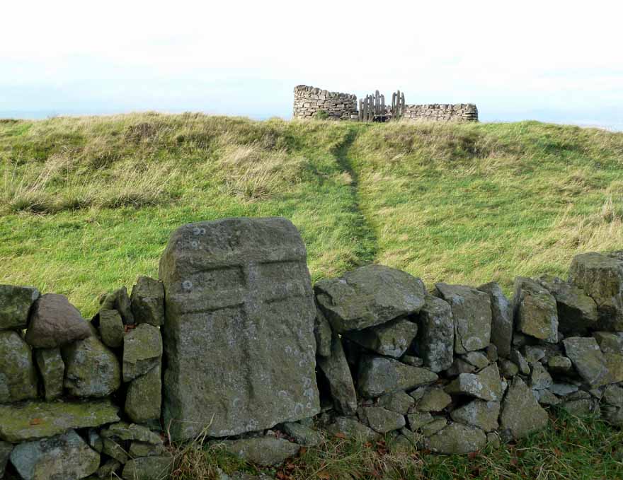
The first tour was Barrhead  past Neilston Pad  along the edge of the  Lochliboside hills past Uplawmoor on minor roads to Dunlop then back along the winding Harelaw dam  minor road,wild and empty of cars,visiting the weird Totherick in mild calm conditions.
A very enjoyable outing.This is Neilston Pad one of the high points of this tangled bedspread of a landscape before it flattens out into high open moorland beyond.And that in a nutshell is its charm.
When the  Ice age retreated glacial deposits were left all over the central bowl including Renfrewshire.
Edinburgh is a city built around the sides of ancient volcano,s and stumpy lavas , Glasgow is a city built over Drumlins,a multitude of them , mostly  between fifty to a couple of  hundred feet high.Its what gives both cities their different character.You only have to look at an OS map of Glasgow to see the large number of kettle lochs on it dotted on the outskirts left by stadium sized blocks of melting ice  from that time. I,ve spent many happy years exploring every one.

Something  slightly different happened in Renfrewshire though,maybe more  low hills  got in the way causing deeper wrinkles in the carpet of ice.
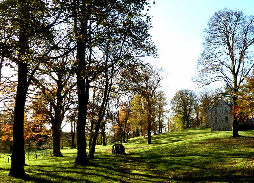
Whatever happened it created this fantastic bumpy part of Scotland.A landscape similar in many ways to parts of inland Dorset,the South Downs,The Sussex Weald.A softer southern patchwork  of gentle ridges and dips, each  hollow might be filled with beech woods,waterways,fields, farms or a village.Its a land built for joyful exploration, every new view containing a multitude of hidden treasures waiting til you stumble across them.Although I grew up just over the border on the outskirts of Glasgow twenty minutes walk over the fields took me into the start of that magic land.Both feet and mind were always going to be pulled in that direction.
The next run saw me park at Castle Semple in the deep trench filled by three separate lochs, the liquid heart of the area.Here,s a view across one of them...The middle one.... The Barr Loch.
The hills above are the start of Clyde Muirsheil Park,the largest regional park in Scotland stretching over
high, empty moors to Largs and Wemyss Bay.Although the modern boundary between Inverclyde and Renfrewshire weaves along rivers and around the edges of small towns like Kilmacolm and Quarrier,s village
I,ve always thought of it  in simple terms as this...Rolling valley and pasture lands...must be Renfrewshire. Higher open moors and hills...Inverclyde or Cunninghame.This is as much a landscape of the mind and as old maps show boundary lines are always changing anyway while the basic characteristics  of the countryside remain.
A magical tower if ever there was one,purpose built here as a Children,s Cathedral. Quarrier,s was laid out as an orphanage village with its own shops, fire station and ornate stone annexe buildings Now,in this day and age the complex has been adapted into smaller units.A mix of private development,care homes for the elderly,social work etc. From a distance and even up close it retains most of its original features though. Mount Zion Tower can be seen for miles around.Long may it stand over the valley to delight each new pair of eyes that beholds it for the first time.Never seen it on any calendar or postcard.It must be an invisible landmark?
http://en.wikipedia.org/wiki/Quarrier's_Village
.
This is looking north towards the lofty spire of Kilmacolm and the Luss hills across the Clyde.The River Clyde was where I was now heading,intending to cycle along a balcony trail high above the water.The great beauty of this area is the network of minor roads that cross it in every direction.Once there the landscape changes again with different views on show.
Dumbarton Castle on its volcanic plug of rock.Always a great sight from here.I have limited myself to a few of the best shots to try to capture what attracts me so much to this land but on each ride I could have used a hundred more photos almost as good.Yet its such a quiet area with few walkers or tourists.Another of its charms.
From a misty morning it had gradually changed to darker skies and bright bursts of sunshine.I wasn't complaining though.I could even cycle without gloves.Unheard of in late November an hour from darkness.

All in all another satisfying day out and I hope I,ve captured a little of the essence of this place myself in picture form.November has been a very mild month and great for cycling jaunts at the tail end of the year.I did hardly any  bike trips all summer.Making up for it now with Alex busy in hibernation mode.I though I was the one that didn,t like the winter :) Guess what November is best for though.......

Memorable sunsets................... like this one over the Firth of Clyde.

Saturday 19 November 2011

Hill House.Glen Fruin.Three Lochs Way.

It happens a lot that you go to a place then notice other possibilities just by going there.The very next weekend after my Roseneath Peninsula Bike Ride posted here on 30th august 2011 I was back again In Helensburgh keen to explore further.Not had a chance to put it in til now. So...Parked in the same large free car park down at the pier.The shows were still on and Britney,s Toxic had been replaced by Katy Perry,s Extra Terrestrial booming out.I don't mind it nice and jumpy for short periods but I wouldn,t fancy living close by.For me though it was very easy to escape.
.I,d looked up Information on the Three Lochs Way,a New long distance walking trail going from Balloch to Inveruglas on Loch Lomond side.It travels through some interesting  hill country, has fantastic views and is circular if you take the ferry across to Inversnaid and return down the West Highland Way.A lot of these new trails are appearing all over Scotland promoted by local areas keen to have visitors numbers staying and spending in the vicinity.
http://www.threelochsway.co.uk/balloch-helensbu.html  Good maps of the route here also.
This one looks interesting as it visits some lovely wild scenery,interspersed with gun ranges,private MOD roads and little known tracks high above lochs most people zoom past on their way further north.
It was an easy uphill cycle on quiet roads to reach Hill House situated at the top of upper Helensburgh.I,d read the large garden surrounding the house was free to visit and it was someplace I,d never been.That was enough.I,m not a big fan of Charles Rennie Mackintosh though.He was unique and his ideas are bold and visionary with furniture and  high backed chairs that look as if they were designed for aliens with eight foot spines but the outside of his buildings often look cold and detached.Just as well they are now saved for the nation,they don't look comfortable places to live in.The garden matched the house,large but fairly spartan.It didn't have enough colour,flowers or wildlife in it for my tastes.I didn't stay long and as I know Mackintosh designs well I didn't visit the house itself.Feel free though.It has its own  sizable car park.
I much preferred this house nearby.Now that looks a welcoming place to come home to though a house that size would be a maintenance money pit.Need to have very deep pockets.
Anyway the main reason I was here was to go along the Upland way,an old coffin route, which runs at the back of the house left and right and travels through Highlandman,s wood to Rhu.Its one balcony trail I,ve never done and I do like a balcony trail  as Alex will tell you :)
For part of the way this is also the Three Lochs Trail before it veers uphill across country to the north.You can also do part of this route described as a walk returning via Rhu and the sea front Promanade or take the Three Lochs Trail inland over to Glen Fruin Then Back Along Minor Tracks Via The Reservoirs.This also looks good.Glen Fruin is also the site of the Last great interclan battle in the highlands..A woman distance runner has completed the whole thing in 7.5 hours recently and a good  mountain biker can do it in a day.(one for you Mr Vally?)
I soon discovered its not really suitable for a bike though once past the three  loch turnoff as it has too many dips,tree roots and curves to be a safe ride for someone of my limited ability.I was happy to walk these sections anyway as it only increases erosion on a dirt and grass path like this to ride a bike along it.When I did it  in the summer the trail was fine but the latest information on the link above suggests it is now muddy and rutted given the amount of feet, bikes and rain we have had since then.A large amount of money(£40,000) will have to be found to repair this.Not the result the makers of the way intended but in the words of a well known film...build it and they will come... then walk across it,trample it down and leave you with a trench.I suppose that's always the catch if it proves popular.Luckily much of the way is on decent  broad tracks which can take the numbers involved.There is now a detour in place. I visited the ever popular Mugdock recently above Milingavie for a couple of hours and a lot of the grass trails there were looking pretty trashed and muddy due to continued use in all weathers.
This is one of the views on the upland way.Looking across to Gare Loch, The Kilcreggan Peninsula and then Loch Long.It is very fine scenery in all directions and a nice walk in itself..As it was a better path now,hard packed and firm I got back on the bike for the descent  down into Rhu and Shandon.
At the bottom it was the usual canter along the fairly quiet main road beside the Gare Loch til I reached the Minor road leading up into Glen Fruin.This is the first real highland glen you pass  traveling north up the A82 from Glasgow.The next one up from here is Glen Douglas yet both are quiet and empty of visitors despite having good scenery.Its the usual thing of being hidden out of sight  because its right under everyone,s nose.I include myself in this as I,ve only cycled here twice many years ago in spite of its proximity to Glasgow.
The last time this sign wasn,t on the gate at the entrance though.
As signs go this is a cracker,the red one being the best.Don't know the reason why its here.Maybe some local has issues with the MOD base nearby or thinks he might be sued if someone is accidentally shot on his land....who knows.It didn,t bother me much anyway as its a public road and I wasn't intending to stray off it.
I also remember it being a belter on a bike,good views and peaceful.
Nothing has changed.As you can see from these photos its still the same.
 This is the steep climb up with the hills of Argyll in the distance.I didn't make it all the way up in the saddle and was passed by two younger guys with thin tyre racing bikes and more low gears.They were still struggling though.It was warm and muggy and the sweat was dripping off them with the effort.I was happy to walk and had my first stop at the top for a snack and a drink of juice.
I could now see the Luss hills ahead.On the map,OS sheet 56 Loch Lomond and Inveraray/Trossachs, there is a larger, faster road built above this one running through Glen Fruin.It looks close but you can hardly see or hear it, all it does is take any traffic away leaving this original one serene.The Three Lochs Way passes along here.
Any farmers I came across were friendly and always gave me a wave.This guy was moving sheep to a new field.
After the hard work over the pass its a slow gentle freewheel all the way along the glen itself til near the end at East Kilbride where you cross the Fruin Water then climb up less steeply to reach the main A 818.Views now open up over Loch Lomond and the Campsie/ Fintry hills area.
This is Loch Lomond and Balloch Country Park.Good walks and safe car parking here too.
As I still had a bit of energy left in the legs and hadn,t been round this section I followed the cycle track down to reach  Ross Park and Auchentullich Jetty area on Loch Lomond with its Golf courses and loch side views.Very upmarket,not me at all :)
Wish I hadn,t bothered with this added on bit though as I slogged back over the hill to reach yet another area I,d never visited.This one was much more to my taste.The town reservoirs just above Helensburgh. Here I had a seat to recover and got talking to an elderly woman out with her dog.She was a local,owned a grand house in the upper town but was struggling to pay for the upkeep and heating bills now she was no longer earning money .Her family didn,t want to live in it after they themselves got married preferring something smaller and more modern so she was left sitting  alone in a sleeping bag in this massive pile all winter trying to save costs and did all the housework and gardening herself as well .She was a nice old lady.Its a familiar story sadly. Over the years I have met a lot of people like that where the money has gone yet they still hang on to what they love,often places where they were born and raised a family... so some of these grand houses are not always what they seem.
One of several small reservoirs just  above Helensburgh.Anyone visiting Hill House can walk from here and explore these by using the upland way track.Its a short ten minute walk straight from the house to here.
Well worthwhile.
A great day out with a variety of landscapes.Some of the hills are a bit odd looking around Garlochhead though.

Monday 14 November 2011

South Queensferry.Dalmeny Estate.Mons Hill.

Another nice  day forecast on the east coast.Going over the rising  hump of the high plain on the M8 Motorway between  Glasgow and Edinburgh  however I was starting to wonder if this was the best plan as  it was dull and grey up on the heights past Airdrie. But it turned out a fine day once over onto the eastern seaboard..As I was busy from very early in the morning and only had a half day left I fancied a relaxing trip this time, just somewhere with a shoreline,good views and autumn woods.There would not be many outings left with the leaves still hanging on the trees.This was a fellow cyclist I met below Mons Hill.
I arrived in South Queensferry(locals just call it Queensferry) shortly after 12.00 noon and set off on my bike.I like cycling anyway but I would not have enough time on foot to explore the full Dalmeny Estate and get back before nightfall.I would on a bike however.

Queensferry itself is a pretty town,with its cobbled main street,harbour,shops and seafront.It lies sandwiched in between  the Forth Road and Rail Bridges,looking up at both like a small child protected between two big brothers.Its a good place for a day trip in itself and has fine walks in both directions.Its also got a fair bit of history.The Hawes Inn dates back hundreds of years and was used in Robert Louis Stevenson,s book  Kidnapped, the start of which  of course was set here and  across the river at Cramond. The strange and pagan like ritual of the Burry man parade is held here every year where a local guy is encased from head to toe in sticky burrs only his eyes showing then  he walks through the town.And of course the famous Loony Dook.More Info and links on all that here.http://en.wikipedia.org/wiki/South_Queensferry The history of all the Islands in the Firth of Forth can be found here too.It makes an interesting read. They have been used as quarantine Islands in the past and also in a cruel experiment where a woman that could not speak was placed here alone with her two infants to see if they would grow up speaking the true lanuague of God.This was on Inchkeith which is still a very remote and Isolated place today.On a modern map they no longer print" here be dragons".That would  just invite dragon slayers.Nowadays....they just hide it in the open..in  full view :)
 For walkers and cyclists  however, the Dalmeny Estate is the jewel in the crown.Seat of the Earl and Countess of Rosebury for many generations its  mature woods, meadows, hills and sandy bays are popular with local walkers and cyclists.A circular bike route runs right round the entire estate. 
Apart from that what attracted me however was the fact I,d never been up Mons Hill.Its not high ,around 300 to 400 feet but its got a fantastic view over small shell dotted coves,Sandy beaches,miles of woodland,numerous islands scattered in the Firth of Forth,most of Fife,Lothian and the Central Belt.In short its a gem.I wasn,t really sure if you could go up it but the sign on the entry gate said you were welcome to explore the estate within reason so  long as you were respectful to the livestock and surroundings I didn't see any problem sneaking up for a quick look.There was no sign of a path however so  obviously It doesn't get that many ascents.
I,ve had my eye on this grassy dome for many years now.Its been five or six years since my last visit  here but that was in poor weather when I sheltered in the woods during a violent summer thunderstorm,not interested in climbing a summit running with water and no view.
Now was the hour.
I hid my bike behind a tree just off the tarmac path and set off to claim my prize.The view was worth the wait.

This is a zoom of Inchmickery, full of WW 2 buildings and gun emplacements to protect the Forth Rail bridge and Edinburgh from attack and behind that Inchkeith.
This is nearer at hand.Cramond Isle... and beyond that the gleaming wall of Platinum Point at Leith docks and Granton Docks.

Well pleased with my hill tick I dropped back down to the bike and continued  past Barnbougle Castle and Dalmeny House Itself to Snab Point.
On the beach here I met a fellow outdoor enthusiast and we chatted for a while to see if either of us would turn out to be a nutter or just plain weird.(Hi  Hunter) It must have went well because we decided we were both going in the same direction,towards the shoreline at Cramond.As someone who does his fair share of solo trips its really nice to meet strangers now and again  with similar interests who are happy to engage in casual conversation.It,s something that happens less and less nowadays I,ve noticed.Folk are either wary of your motives,don,t want to engage in talking or are simply too busy.But mostly its a trust issue.
I remember a few weeks ago running after a woman in a Glasgow park(not something I do often) and calling out a couple of times,not that loudly before she eventually turned around to face me.The relief in her face was obvious when I handed her back a toy her child had dropped out the pram.It was a sunny day and the park was fairly busy at the time.Yet Glasgow and Scotland as a whole fare better than a lot of countries.Turned out he was from Glasgow originally so that explains it.Glasgow folk will start a conversation with themselves  if no one else is around.
Ironically the more connected we are through phones,Internet and other machines the more detached and suspicious of each other we are getting as people.Its not a very trusting age. I,m no different to anyone else  in that respect I suppose.
Good view of Edinburgh from here and Arthur,s seat.As he was on foot I rolled the bike along the path beside him til we came out at the River Almond and looked across at the Pub in the tourist mecca of Cramond.This is a very popular spot.There are several car parks nearby and  scenic walks up the river and along the sea front.So near and yet so far.
Up until a few years ago a passenger ferry existed here,just a rowing boat and a ferryman living in the cottage that would take people from one side to the other.There has been a ferry here since the 1660s though sadly now its gone and the nearby Coble Cottage lies empty.There are plans afoot to build a bigger new one though,which given the visitor numbers to this spot makes sense.One that may take bikes linking the two half's together.Edinburgh has a great network of cycle tracks throughout the city and is more advanced than Glasgow in this respect.
Anyway I spent that much time chatting to Hunter about various rock bands, Scottish islands we,d both been to and the like that it was a shock to realise it would be dark in 30 minutes.It was the first  week the clocks had changed.An hour of light less. His car was closer than mine.I got back in the saddle and shot off.A quick look at the big house then it was steady peddling through the trees,the lights of the various towns in Fife twinkling in the gathering  gloom.Although warm before It was  certainly November now alright, cycling  fast without the sun.I also wondered if the car park at Queensferry had a gate on it that would be locked at nightfall by someone.This thought made me go like the clappers,the forest whizzing past.
Luckily this was not the case and I arrived back to a bumpy shudder along the cobbles and a welcome haggis supper takeaway at a nearby fine dining establishment.I sat on a bench at the car park in the almost dark watching several rabbits munch the grass nearby while I had my chips.The lights of both bridges ,North Queensferry and Dalgety Bay as an illuminated backdrop. A grand day out.

Monday 7 November 2011

Torphichen Hills. Preceptory.Korean War Memorial.Linlithgow Loch.

Sometimes you visit a place then something else  interesting comes out of it.My cycle around the Bathgate hills got me thinking about Torphichan Preceptory nearby.I,d been here several times many years ago using Torphichen as a base for cycling trips in the area.When you are young its all go go go without spending much time delving deeper into the history of an area.Well, it certainly was in my case anyway but as you grow older you want to know more about  the district you are in.When I got back this time I looked at the map (Falkirk and West Lothian Sheet 65) and spotted for the first time an improbable route through the Torphichen hills.I didn,t have a clue if it was possible or if I would find it dull or uninspiring or closed to walkers but sometimes just going there and attempting it without any knowledge beforehand brings the best results.In the end it was a great new walk through  rolling,varied scenery.Constantly interesting with a few surprises in store.I had a wonderful day,more so as it was unexpected.

Torphichen Preceptory itself is unique in Scotland.The entire village it sits in is hidden away on its wooded ridge, half forgotten but treasured by those who live there.I knew it was founded by the Knights of St John of Jerusalem in 1140 but other than what I,d read in a quick passing look at the church yard information boards about them that was it.I was younger  then and it was still all go go go.Now, I thought why would they pick here..tucked away in this obscure low hill range in the central belt? It turned out to be one of the most interesting and informative trips yet from a research point of view once I got back and a cracking walk into the bargain on an unknown(to me anyway) right of way public path between Torpichen and Linlithgow over the hills.It was from here and only one other place in the UK( London) the Knights  regrouped and operated from an organisation originally founded to protect pilgrims going to the holy lands.Although  set up as warrior monks similar to the feared Knights Templar and the Knights Teutonic(a German Order) they were also involved from the outset in caring for the poor, sick and injured.These three groups were the SAS of their day,highly equipped ,well trained and motivated by religious certainty.They would charge on their heavy horses into the gathered ranks of the enemy army like a thunderclap from god himself.Self doubt and fear didn,t appear much on these guys menu.(Remember the Black Knight in Monty Python who gets his limbs hacked off one by one yet  still refuses to stop fighting and surrender when he,s  down to just a torso and a head.) However they also helped set up the first Cheques,Banks, and Multinational companies.The Knights of St John fared better than the Templars who made the usual mistake of growing too powerful and attracting the attention of a worried King.The Knights of St John survived however, gained former Templar lands as here and after many changes and adaptations to the political landscape of the times they are now  better known today as the St John,s Ambulance.You couldnt make it up!
Full fascinating account of all three groups here.Look under DECLINE paragraph for Knights Hospitaller(Knights of St John)Amazing stuff.Torphichen Preceptory is also here under SEE ALSO. in Knights Hospitaller page..http://en.wikipedia.org/wiki/History_of_the_Knights_Templar
The Path I followed after leaving the village took me north to Craigland on a minor road then followed a rough track East  through splendid autumnal woods past  the still standing remains of an ancient tower(marked on map).A wooden sign beyond pointed uphill north under the bulk of Cockleroy and you could easily climb this hill  from here if you haven't done it then come out at the car park but as I,d been up it too many times I followed the track down to a field  instead where it petered out.The right of way path was between Torphichen and Linlithgow but I wanted a circular route so veered east towards a small round dam.This was inspected(Family of swans and a bunch of Jays) then passed  to reach the road.I then snaked up through Beecraigs forest trails(if you don,t know these best to stick to the yellow tarmac road) then came out higher up near the road at wardlaw.

The Korean War Memorial is here with its lay by parking bays.I,ve passed this many times and to be honest it didn't look worthwhile stopping.How wrong can you be.A lovely landscaped little garden and shrine to the people and nations that served in the Korean War(1950-1953) and a path up the side of Witchcraig hill which turned out to be a fantastic viewpoint over a wide area.
The shrine is below.This also gives you an idea of the scenery involved on this walk.Not that high but stunningly beautiful rolling hills.And so quiet with most outdoor  folk busy on the greater ranges instead.I could actually see the northern edge of the highlands from here plastered with fresh snow but I didn,t fancy swapping places, no doubt a penetrating bitter wind up there on those heights.Here I could still feel as if I was in summer mode  in the more sheltered glades ,warm and safe from the cold wind in bright sunshine.Winter will come soon enough...I,m in no hurry to rush into it just yet.
 Also up here is a very strange object.I knew it immediately as a cross of Lorraine same as the one that sits above Greenock but I didn't have a clue what it was for til I returned and looked it up.Its a refuge stone.
There is a ring of them sitting in the landscape an old Scots mile out From Torphichen.In the days of The Knights of St John anyone in trouble reaching the safety of this ring would be safe from retribution for any ill deeds they might have done.Mind you no doubt the good knights would ask for something in return.There,s always a catch somewhere :)  From here a grassy trail leads along a mini rock escarpment  in the direction of Cairnpapple Hill which you could also do as part of this walk.I however descended to pick up the road again as I was going back via gormyre and that minor tarmac ribbon.As it was overhung  most of the way with shimmering dappled beech leaves it was a joy to walk.I got mobbed by some rooks on Witchcraig Hill Escarpment.Unusual in that they treated me more like a fox or raptor than a human who might have a gun and came fairly close,repeatedly circling above me before deciding I was OK after all.I didnt mind this at all.It was great for photographs.
A very interesting walk with bags of wildlife.Even seen a stoat and a Kingfisher.Too fast to get pictures though.Tricky wee buggers to capture as a chance face to face meeting like this.You need to set it up then lie still for hours...waiting.....thats not  for me.
Back at the car I still had enough time before it got dark to drive to Linlithgow and park there to walk round its loch.I,d seen it sparkling in the distance of course from the hills so I just had to pay it another visit.Its such a great  area for views and photography.
The loch and Fishermen.Great range of birdlife.Great crested grebes,assorted ducks,coots,moorhens,dabchicks,swans...its got the lot.
and buckets of history as well.Mary Queen of Scots birthplace.Linlithgow Palace.
And finally...This is the view from the hills above Williamcraigs.