ALL PHOTOS CLICK FULL SCREEN.
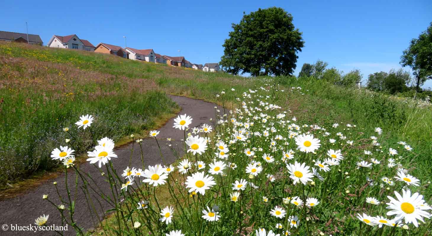
I had a free afternoon a few weeks ago and was heading over to Rouken Glen Park near Thornliebank when I passed by the bottom of South Nitshill. This view of the half circle of open meadow that surrounds the estate on its northern side took my breath away and I instantly realized I would have a more interesting and enjoyable time here. So I parked discreetly in the small trading estate behind the Nia Roo pub and went for a wander. As you can see it's beautiful here.

It was the extensive carpet of buttercups that stopped me in my tracks, the best I'd seen anywhere and I knew this was where I wanted to be. Rouken Glen Park is nice but I've been there umpteen times so it held few surprises whereas this area still did, judging by this unexpected display of colour. Kennishead Flats in distance.
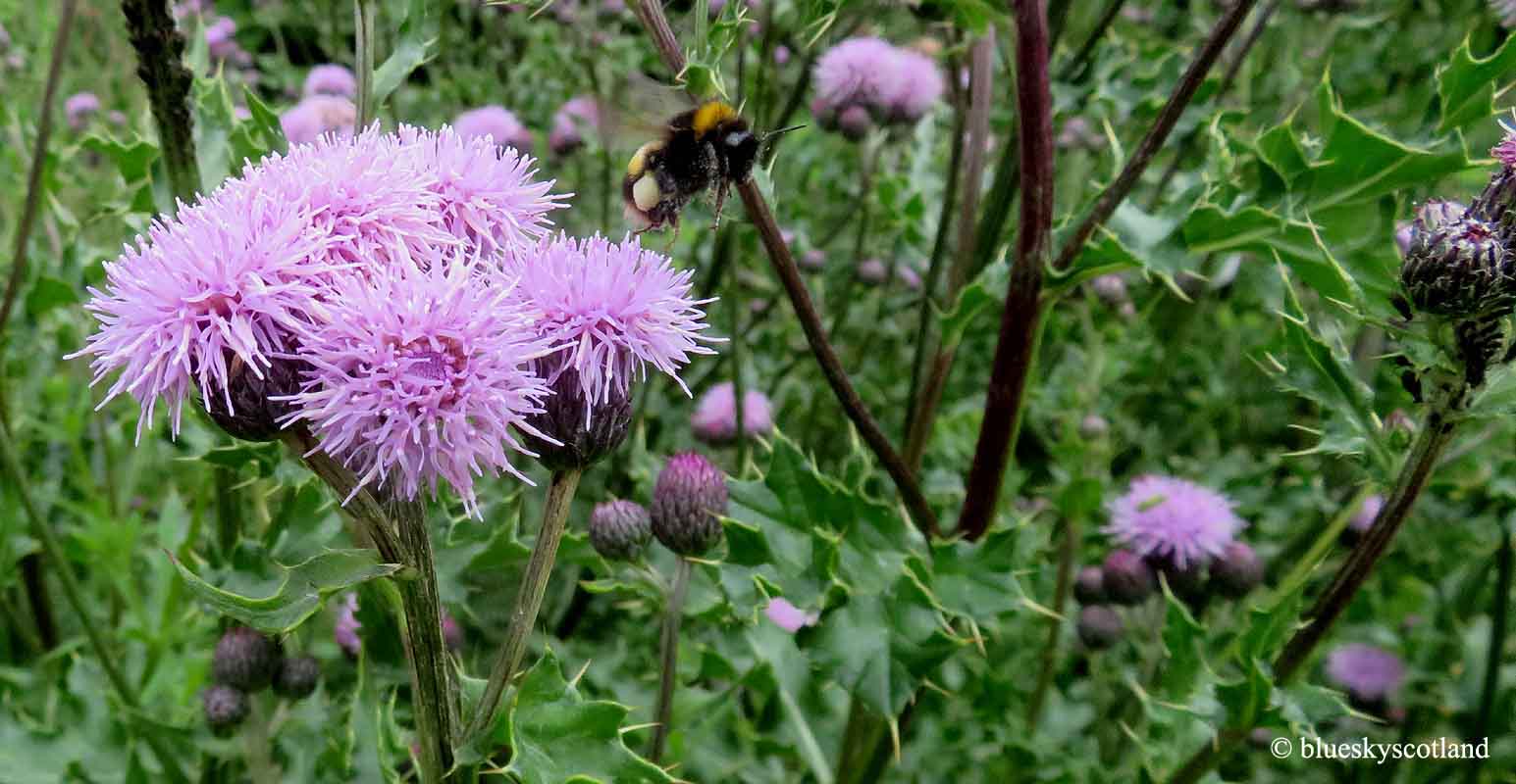
The whole hillside was alive with bees, butterflies and wild flowers and it transported me right back to the reason I fell in love with this place from the moment I arrived here. As some of you may know I spent the first 27 years of my life here and it was a fantastic place to grow up in the 1960s and 1970s. Even today you can superimpose a giant clock face over this estate and craft an excellent rural or semi rural different walk for every hour around that clock. There's few other places in Glasgow, or anywhere else for that matter, where you can do that. 12 different walks with many variations possible.

A view of Nitshill from South Nitshill in 2022. This wide banana shaped slope was always referred to as 'the grassy hill' by locals and as kids we loved it. Normally it was green grass that covered it and for most of the year it was not as long as it is here but from 5 to 15 it was a great playground and escape. In the summer months you could often watch kestrels hovering here in search of mice, or look for mice, birds or reptiles yourself or just loose yourself in your own imagination on a hot summers day.

It was also a safe place to play, free of cars or adults, so for a child it was the perfect size to explore and for its modest height it offered great views over the local area and the city of Glasgow beyond. The Lochliboside hills, The Fereneze Hills and the Brownside Braes were always visible in the distance, as seen here, offering a glimpse of greater treasures to find once we got older.

Up until the age of 9 or 10 though this grassy hill, and the back courts we lived in became our universe. Growing up in the 1960s we had a level of personal freedom almost unimaginable to children today. From about primary school age we could wander anywhere around this estate on our own, usually with same aged friends. After a school day, primary and secondary, this 'stairway to heaven' led up to the scheme, with one long front row of 4 storey tenements encountered first (Whitehaugh Road and Crescent) then several other long rows of three storey tenements behind the first one... stairs which I used daily Monday to Friday to get home.

The heart of Pollok. Silverburn shopping centre in 2022. At it's 1970s height roughly 50,000 inhabitants hidden within a forest lived here. That's why every walk was special. The magic didn't work for everyone though. Apparently Moors Murderer Ian Brady lived in Pollok in the 1940s and early 1950s before going on to Manchester and notoriety so beautiful surroundings had a different effect on him. And he didn't live in rough tenement land like us but in a more pleasant garden suburb district of Pollok with low level cottage type housing stock that remains intact and in good order to this day.
During secondary school I would take the bus to school in the morning as it was down in the centre of Pollok but coming home, if it wasn't raining, I would often get off here just for the sheer joy of climbing these stairs again or traversing the full half circle of the hillside. Even after hundreds of ascents and descents I never tired of it and did the same again this time. Just as special today.

Looking down the stairs towards Nitshill. Most of the inhabitants of Pollok/ Nitshill came from Glasgow's inner city districts like the Gorbals (Ian Brady), Kinning Park (me and my sister), and Govan having lived or grown up in 100 year old tenement slums there. Nitshill/Pollok was on the southern outskirts of Glasgow and had previously been rural farmland and grand estate grounds in Renfrewshire. Even though Nitshill was an ex mining village and Industrial Revolution hub with brick-works, small factories, and semi abandoned buildings by the 1960s it was winding down so for us it was an incredibly green and leafy place.

Good to see the Nia Roo pub still open in 2022 when so many others have closed UK wide. I'm including this photo because in the 1960s this trading estate didn't exist and an abandoned flooded quarry sat in a large area of waste ground ( on old maps it's down as a reservoir but I remember it more as a flooded quarry.)The flat roofed three storey tenements of Priesthill, built in the early 1950s formed a diadem around this hill, with a large, high, dark looking, water tower placed right in the middle on top of everything like a crown. I always thought it had a slightly sinister appearance. I didn't visit this quarry much as the Priesthill kids thought of it as their own and we sometimes got beaten up here if they caught us. Being an older established scheme Priesthill kids were tough! Instead of these factory buildings it was just thin scrub land with an abandoned mineral railway from the Fireclay quarry and mine running behind the Darnley Hospital as it was then. The rails and sleepers still in place but under a few inches of water. Corncrakes could be heard in the field nearby. At the top of the grassy hill near the spot where this photo was taken two small coal bings stood. One was bigger than the other, maybe 20 feet high at a guess? I remember sliding down them but they suddenly disappeared, maybe after Abervan in 1966 as that would be about the time they vanished. The old Darnley Fire Station was still operating in the early 1960s and I remember getting a primary school tour inside it before it closed down. We then got an unofficial 'abandoned engineering' tour of the roof and tower of this structure before this disappeared as well. The tram lines from Thornliebank passing Darnley going up the side of Parkhouse Road were also visible for a few years before they too were lifted.

Leverndale Tower and Cleeves Road, where the brick works once stood. According to old maps online from the 1800s numerous quarries, ironstone pits, and coal mines surrounded Nitshill, plus a chemical works, but they were mostly invisible by the time I arrived. At the bottom of the grassy hill though, where the red car is, a shallow pond once stood, about the size of a tennis court fringed by a ring of scabby stunted trees. The water was always dirty looking and I never saw anything swimming in it or any birds in the trees so I wasn't bothered when it too disappeared in the late 1960s. This was probably when the grassy hill was smoothed out as before that time it was more rugged and bumpy with a six foot deep shallow canyon half down the main steps featured earlier, on the right hand side looking down. A set of long metal pipes sat stacked to the right of the pond on the open hillside for many years as a preferred storage location until they were moved inside the fence where the yellow JCB is. Probably a health and safety issue with children crawling all over them occasionally.

Remarkably there's still metal pipes stored inside there to this day, 50 years later! Amazing! So there are changes here but also some things stay the same.

One taken in the winter time, 1990s I think, with Parkhouse Road under heavy snow and a stuck bus. The biggest change to this area was the building of the Darnley Deck Access Estate in the early 1970s on previously open farmland, The Parkhouse Estate, the edge of it seen here on the left soon followed, Then the Southpark Village and Darnley Mains Estate and the Deaconsbank Estate, The last four private owner occupier estates built over what was once fondly remembered fields and farmland. One of the real assets for me, living here then,was the natural transition from exploring the grassy hill... occupied and loved from 5 to 10 years of age roughly.... to the next great leap further afield... 10 to 27.... exploring the great unknown on the other side of this road. Before the Parkhouse Estate arrived 20 paces from my front door led us into 7 or 8 huge fields, some of them filled with contented grazing dairy cows, some empty for gathering hay to feed the cattle in winter and some of crops, usually golden swaying corn or occasionally turnips. There was even a modest hay harvest. Every field was bordered with hedgerows filled with bird life. Numerous small woods completed the picture. The Darnley area and other districts mentioned were the same... gradually gobbling up fields year by year and three working farms disappeared. Just out of curiousity I measured the acres of beautiful rural landscape lost since 1970 in this area that I spent many happy years exploring and you could disappear Queen's Park, Rouken Glen Park, Bellahouton Park, Victoria Park ( all in Glasgow) and Barshaw Park in Pasiley to get the equivalent acres we used to roam across all during the 1960s here. The original Darnley estate was great though... deck access buildings two, three, five, and seven levels high with open corridors that meant you could walk from one end to the other without coming down. 'Streets in the sky' and a great playground. The modern Darnley, and the other low level estates are probably very pleasant places to live now... but less exciting.

I had a tour round the old estate on my bike in the late 1990s just before it was knocked down. Woodfoot Road area here. At the start it was a good scheme, every house filled with tenants, but when I reached my teenage years in the 1970s it turned rougher, like all the big Glasgow council estates of that era. By the late 1990s... early 2000s the big four... Pollok, Easterhouse, Castlemilk and Drumchapel had demolished most of the tenements in them and almost halved the population in these areas. Around 30,000 and more reduced to around 15,000 today.

As I was spending most of my free time over the fields, woods, and Barrhead Dams anyway I largely avoided any gangs or teenage peer pressure to do things that might/would get me into trouble. You could either have this version of the 'beautiful south.'....

Or this one... half an hour's walk away across rolling fields with dairy cows in them.

I personally liked the contrast with two very different worlds side by side... this... (Woodfoot Quadrant)...

... or this... rural Renfrewshire an hour's bike ride away... Cattle and drumlin country...

Or this...Rouken Glen Park.... half an hour away up Nitshill Road past Arden....

Then back to this again... South Nitshill local shops. Now there's no shops at all in the estate. There used to be two sets. One set of five or six here and another similar set down in the valley at the other end of the estate/scheme. The name might possibly come from Nutshill as a hazel wood is reputed to have once been in this district and before this estate arrived here it was a dairy farm and open fields in what was then rural Renfrewshire. The Hazelwood pub in Nitshill certainly alludes to that idea.

Willowford Road and 'the valley' part of South Nitshill. The original lower houses here still remaining plus some new owner occupier starter homes built where the primary school used to be, opposite St Bernard's Catholic Church, which is still there.

As is the takeaway, halfway up the hill. Once a doctor's surgery... then the Sky Dragon ... it still seems to be doing business. Although no local shops exist within South Nitshill nowadays, apart from this one they do have a large Lidl, a similar sized B and M store (both at the bottom of the grassy hill and featured in this post) plus a Sainsbury at Darnley, all within walking distance, plus the Silverburn Shopping Centre in the middle of Pollok, none of which existed in the 1960s and 1970s so I can't see the two rows of closed local shops within this estate coming back again anytime soon. Nitshill Village still retains its own row of traditional local shops, accessible through an underpass for 'the valley' cluster of houses, so they too have a good choice of shopping nowadays, especially with a car. Far fewer cars in the S. N. estate in the 1960s and 1970s.

Nitshill village and its traditional row of local shops beside Nitshill Railway Station.

The old tenements are long gone in South Nitshill and a new set have taken their place on Parkhouse Road, seen here. The fantastic rural countryside still surrounds this re-modeled estate it's just slightly further away than it used to be but only by another 15 mins walk in this direction to pass the Parkhouse Estate, hidden in the dip.


A Renfrewshire bike ride in the area from years ago, above. Wandering around the area this time I found myself thinking "I could live here again, no problem" as it has such a great variety of walks even today, in every direction.... so part two is next....
Good link here and old maps and photos detailing Nitshill's industrial past.
https://en.wikipedia.org/wiki/Darnley_Lime_Works_Tramway_and_Mineral_Railway
10 comments:
I was going to ask you why it was called 'Nitshill' but you must have guessed! Amazing to hear corncrakes around Glasgow - I've never heard one in all my roamings in the countryside...
We have a quarry in my ex-village and so there were slagheaps (bings to you) which we always used to play on. They weren't near enough to the village to cause problems though - they were great fun to play on. Ours were more like 50 - 100 feet high - really big ones.
"From about primary school age we could wander anywhere around this estate on our own, usually with same aged friends" - they still could do that but mummy won't let them apparently. Things are not more dangerous nowadays than they were then - they'd be perfectly safe out playing with their mates - just so long as they're not out on their own.
Hi Carol,
I've only heard corncrakes in Uig on Skye in the last few decades but over the fields from Nitshill in the 1960s we regularly spotted linnets, greenfinches,bullfinches, goldfinches and goldcrests, yellowhammers, newts, water voles, lapwings,skylarks, the list is endless and many of them are not there now as the vegetation is matted and dense without livestock to mow it down to short grass. I think things are more dangerous now however for children with increased traffic on all the roads, more bikes and scooters, including electric ones going at speed on pavements (I've nearly been knocked down twice outside my house by them in the last few years) and more bad people about or ones less interested in getting involved if children are in trouble in case they themselves become a suspect. Plus we never had anything in the house to entertain us back then so we had to go outside.
Maybe we were just lucky as I do know of many children in Glasgow at that time, the 1960s and 1970s who weren't so fortunate.
I always think that Nitshill is a very unappealing name so like Carol I was interested to know how the name might have come about - nuts have far more appeal than nits!!!
I have never heard a Corncrake or even seen one, but I once watched a very interesting 'live' TV programme from the Outer Hebrides on a summer evening, when several males were loudly calling.
Hi Rosemary,
Growing up from a toddler there it was just a name to me so I never thought of the nit connotation at all, although with large class sizes and not the same hygiene guidelines/methods/facilities that are taken for granted today the 'nit nurse' was a common feature in most UK schools in the 1960s and 1970s but being used to the placename from an early age that aspect was never connected in my mind at any time. If anyone asked locally we always used to refer to ourselves as 'coming from Southie' not because we were ashamed of the Nitshill name but because we lived in a separate scheme/ estate from Nitshill and anyone local knew that difference in location as soon as we said it.
My Dad was with me on that occasion (I was about six years old at that time) and we were exploring the watery wasteland behind the Darnley Hospital. (a district, incidentally, that gets it's name from Lord Darnley who owned the estate lands there, including Crookston Castle, and where he courted Mary, Queen of Scots before they got married.) My Dad had heard corncrakes regularly during his own childhood when they were common Scotland wide but now they are confined to a few remote Scottish islands like the Hebrides. Last time I spotted a linnet, a water vole, a grass snake, a slow worm, or a full sized newt was across the fields from S.N. so I always associated it as a truly magical environment, despite a tenement upbringing and subsequent demolition of most of the original estate. The reason I remember it is because it was a great day and he was really pleased to hear one (a corncrake) telling my mother afterwards about it.
Lovely memories to have! My childhood was quite fragmented in terms of numbers of places lived, and all far from where I am now. However, I enjoy occasional visits back to the old haunts!
Cheers Anabel,
it's not really the houses for me as they are all gone it's the surrounding undulating countryside, which I've always thought was totally unique in Scotland yet greatly undervalued. Nowhere else in Scotland or Northern England that I've been has that egg box landscape of drumlins stretching for miles in every direction or the variety of features within it. It's more like some of the famous Southern England hill groups in many ways, most of which are national parks or designated areas of outstanding natural beauty. Be a real shame if they cover it in houses in the future. Mind you, we may not have a future if certain people at the top... republicans, fossil fuel companies, various billionaires etc still put profits before saving the planet. Which I suspect they will do until it's too late.
We left Govan when I was maybe 3 or 4 and lived in that L shaped block in your photo of Woodfoot Quad, 20 I think. Played on the hurlet and in the fire station ruins. Went to the Sunday school with my Proddy cousins! Used to go to the row of shops on my bike and to the chippy, where the Chinese is now. Went to mass in St. Bernards chapel. I suppose they were decent houses then, late 60s, I liked it there, but we left for Ireland in 75. Went back for a visit around mid 90s, prob just before it was torn down. Was quite sad to see the place in ruins. Nice fancy houses now that we could never have afforded. Love your pics and your stories. Catherine McManamon
Cheers Catherine,
I still love the countryside around Nitshill and Pollok and it's still special. Was at a funeral a few days ago in the new crematorium at the Hurlet in Barrhead next to the country church at Salterland Road where my sister got married in the late 1960s/early 1970s (long gone now) and the view out the crematorium window was of rolling green fields and munching black and white dairy cattle. A view I used to see nearly every day on Parkhouse Road when it was all fields from there to the dams.
I was struck though travelling through Northern Ireland from Derry airport in a car to Donegal over the last two decades how similar the rural landscape is to parts of Renfrewshire (Barrhead) and Ayrshire. Even Locals, blindfolded then placed in an unfamiliar set of fields might not be able to say if its Ireland or Scotland. Same rolling countryside, hedgerows, munching cattle, small woods, scattered farms, and B roads.
I remember growing up in south nitshill great memories and great people stayed in Parkhouse rd great neighbours
I grew up in Darnley Hospital from 1950 till 1973 when my dad retired and we moved to Livingston. Unfortunately I have no photos. Has anyone out there got photos of the hospital or Nitshill from the early 60s?
Post a Comment