ALL PHOTOS CLICK FULL SCREEN

A view of the recently developed Claypits area at Maryhill. My initial plan/idea was to walk from Gartnavel Hospital and Binghams Pond (see last post a week ago for that) and end up at the newly completed Claypits but once we had wandered round that (Anne and myself) we found ourselves on the edge of the district called Hamiltonhill.
Neither of us had been in Hamiltonhill before, a working class neighbourhood on the north of Glasgow next to Possilpark, but the Claypits Nature Reserve higher path network took us out there, almost by accident. For someone like me who has a long history of exploring Scottish towns and cities, plus countless urban housing estates for the last 50 years this sudden blank in my knowledge was very unusual.... to have no idea of what buildings once stood here was rather unique. Looking at old Glasgow street maps of this area from the 1970s long rows of houses turned this into a heavily built up district at one time but I've no idea if it was cottage type houses, lines of tenements or something else. Cottage type houses, even those built in the 1920s and 1930s usually last and are still around today while it's usually tenement clusters that get run down and demolished.
I presumed they had been knocked down and disappeared fairly recently but looking online this blank area, the size of a large city park, has been empty and green, even better tended with iron benches and large flower containers plus DIY football areas and short mown grass as far back as 2015. It was a mystery as the remaining houses here, still well tended with nice gardens, were of the low level cottage type so what stood here... tenements?... a couple of schools...., or more cottage types? I've no idea.
It was a strange experience for both of us and you can see in this one the remaining surrounding low level houses still left, a black metal plant container and a set of goal posts as if an attempt has been made to turn it into a local park when the houses first disappeared... whenever that was. Looking at my old street map from 2009 all the streets here are still shown standing in rows of domestic properties but Hamiltonhill Street, Bonhill Street, Appleby Street, Dartford Street, Denham Street and several more have now gone... replaced by empty ground, abandoned lamp posts and wide grass meadows.

A goldfinch in Hamiltonhill. I'm well used to exploring waste ground within the city boundaries however and Glasgow is full of these once busy post industrial failed estate areas. Drumchapel, Pollok, Easterhouse, and Castlemilk all have former streets of houses and once packed residential districts now lying empty and abandoned with wild nature gradually reclaiming them. Roe deer, birds, insects, and foxes moving in. A couple of years ago I wandered round Westerhill Street, Lyall Street, Peathill Street and Scone Street just off Keppochhill Road, beside Cowlairs Park... an area long flattened and abandoned 20 to 30 years ago... so much so that you can hardly make out anything at all with trees 20 feet tall covering each street... yet you can still look up current house prices online for sale of these non existent streets and flats that vanished decades ago. Weirdly some of the street names are still there, fixed in place on poles, yet adjacent tarmac ribbons are quickly disappearing beneath thick woodlands... and on the 'hidden Glasgow' site pleasant memories of growing up and going to school there within this self contained small tenement district of half a dozen streets are alive and thriving. The adjacent Cowlairs Park is an overgrown, wildly abandoned, and scary place that I explored a while back, looking behind me a lot, and keeping my wits about me for brick wielding feral types at all times. Despite Glasgow winning several recent magazine awards in 2022 for 'friendliest city in the UK/world', 'best city to visit' at no 4 on a world list of 53 cities (Edinburgh was first. Chicago second.) certain parts of Glasgow ( that tourists never visit) give a different impression. Glasgow City Centre, incidentally, for tourists, is usually cheaper than Edinburgh to visit as many of its museums, art galleries etc are either free or cheaper than those in the Scottish capital.

Hamiltonhill Hi Rise Flats. We both enjoyed it here however as it was just like finding a hitherto unknown city park to walk across.

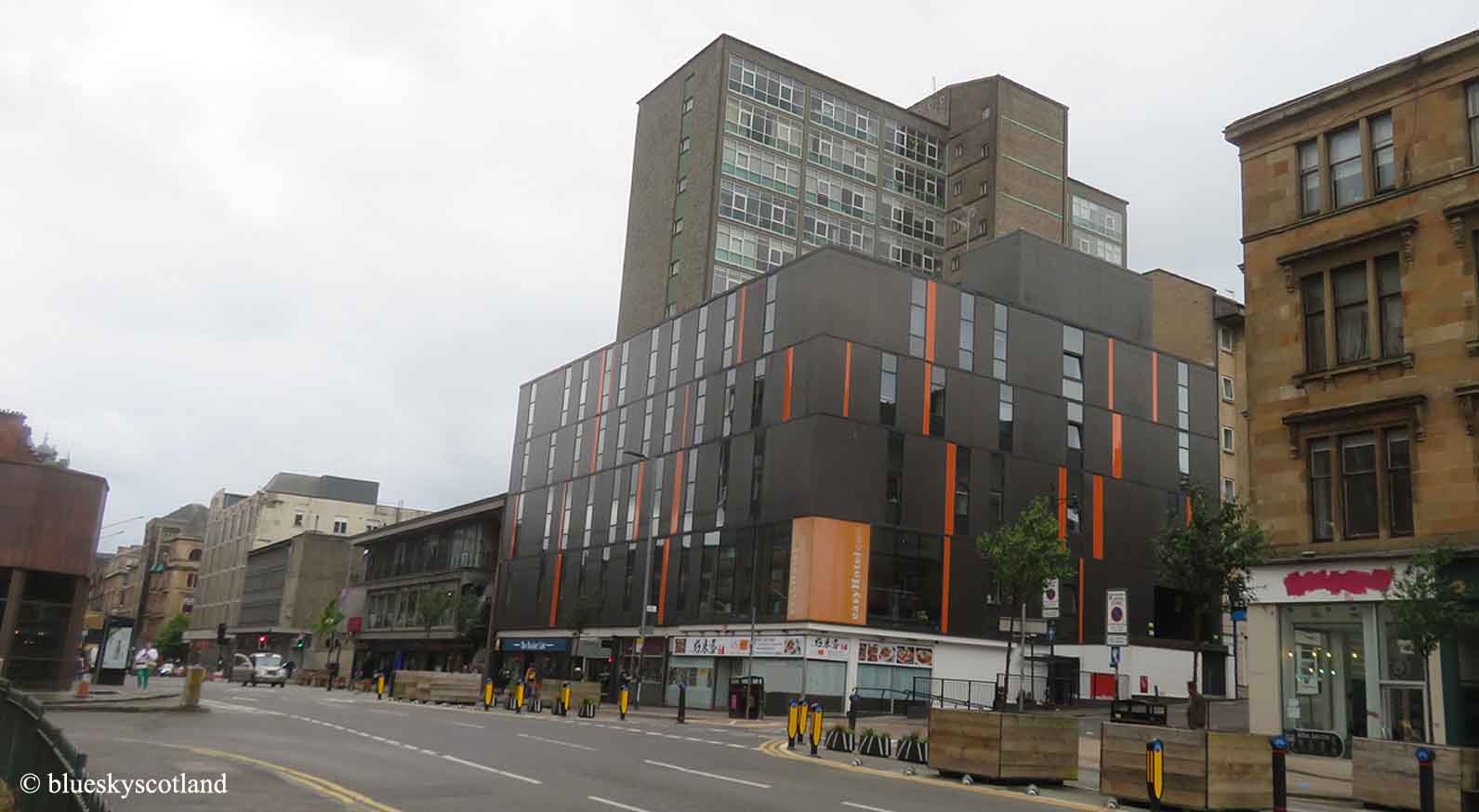
More waste ground wanderings in Hamiltonhill looking across at Springburn and Springburn Park. A brooding sky in this one but although it looked like an approaching thunderstorm was about to burst forth at any minute it stayed dry, humid, and warm.

Where the woods are here in the distance, immediately left of the Hi Rise flats of Roystonhill, is where the long abandoned community I mentioned stood beside Keppochhill Road. This is also a green park-like area you can visit from here. Just like abandoned urban areas of post industrial Detroit are now turning into city farms, growing crops, so too are parts of outer Glasgow, like here, returning to full wilderness. At one time, in the 1920s to 1960s era, a tightly packed Glasgow had over one million citizens within its boundaries but now with several over spill towns like East Kilbride, Cumbernauld, Glenrothes, Erskine, and Irvine sucking residents away, it's currently around 600,000 in population although roughly two million people live within the Greater Clyde Valley Conurbation, like Paisley, Hamilton, Airdrie, Motherwell etc and other surrounding towns and suburbs of the west coast urban sprawl.

It is strange though to wander round these deserted districts... feeling like the Omega Man/Woman... or an extra in The Last of Us, (The first one) ( An excellent and visually beautiful computer game that can also be watched on You Tube as a stunning and surprisingly enjoyable post apocalyptic film.)

'Waste ground' is never wasted where nature is concerned however and this place was alive with bees, leg rubbing crickets, hoverflies, and other insects making a home here.

A row of abandoned looking shops in Hamiltonhill. Ellesmere Street. Any customers long departed elsewhere. As of 2024 this row has been saved, remodeled, and one is now currently a hairdresser I believe.

Wandering past here took us out to Applecross Wharf on the Forth and Clyde Canal and sweet scented carpets of white clover. We had a seat and a lunch break here with two prized pineapple cakes each from a local bakery shop.

And following this canal in turn took us down to the Wave Park, Glasgow Kayak Centre and Monklands Canal under Port Dundas. Anne had been with me a few months ago when we passed North Bridge, the new estate being built in Sighthill, from the other direction, that is still under construction so we were curious to see how it was progressing.

Like the Claypits district a lot of hard cash and newly constructed landscaping is occurring here. This is looking up towards Port Dundas.

Hopefully this small hill will be a lookout view point in a new public access area.

The new North Bridge development. My first thought here was 'Hhmmmm. Long slope.... looks good for skateboards, electric scooters, and roller skates... or Parkour jumping'. Personally, I always think designers/ architects/ town planners should have an ordinary working class common sense person as an extra technical advisor. Even just for a look at the computer generated model images before the actual build starts. Anyone reasonably intelligent from a council housing scheme/ estate background might have told them putting old folks immediately above rows of local shops in the various council estates in the 1950s- 1970s was a bad idea... likewise constructing deck access estates with no personal space boundary markers ( i.e. there's a gang standing right outside my front door every night but I can't say anything as it's a freely available open public corridor) Likewise this place here...and... so many decorative slabs and trees.....with all the seating in this area it looks like an open hub you are meant to congregate in, for whatever purpose eludes me at present... but I can guess local teenagers might find this an obvious outdoor attraction away from public scrutiny, all that's missing is a roof to shelter under in bad weather. Local groups of kids had already found it when we were there in the early evening and it's not even finished yet, the surrounding houses still being built. Like us they were just curious at anything new appearing in their district, offering some fresh visual excitement. But vandalism may soon take hold. I hope not but history says otherwise.

I get the Claypits area with it's path network and sloping ramps for ease of access but we ( Anne and myself) failed to see any merit in this sunken area. It obviously cost a huge chunk of money.. millions at a guess... for this entire hard landscaping project over two hills but unless this is a spectacular water feature or something vital to the canal/ water operation I can't see the point of it being here. All I see is very unfriendly ground and an accident waiting to happen for kids larking around and falling badly on hard edged surfaces or older folk tripping over unintentionally. All the wire netting and different steps/levels everywhere is just asking for trouble. And, as I said, I can see it getting vandalized, run down, or neglected, as well, fairly quickly.

I can't see the point of these individual chairs either when you've already got two benches for sitting on behind them. True these chairs look more comfortable but my council scheme instinct/intelligence informs me that they might not last very long. No houses nearby to safeguard their welfare. Poor little chairs. Victims in waiting. Someone rescue them before it's too late and the bad people come and hurt them.

I do get this though. This should last for decades to come. All you really need here is a few pleasant paths, like this one, running through a beautiful green area: nothing to vandalize, and a few ordinary tried and tested bolted in place park benches scattered here and there for a rest and a view. Nothing else, nothing too costly... save a bundle of money for other things, like local public facilities/ infrastructure perhaps, more worthwhile in the district that will be more useful and last longer. I think the locals would be happy with that. I would be.

As the fabled bridge (in North Bridge) connecting this district to the city centre over the M8 Motorway wasn't open to the public yet we had no choice but to retrace our steps back past the Wave Park ( a water sports and kayak centre) and then down through the various city districts to Anderston train station for the journey home.

A long and varied walk but a very interesting one. Passing Cowcaddens district here. So named because in previous centuries any cattle gathered in from the surrounding countryside heading for city slaughter used to be rested on the grassy slopes of Cow-lairs first (later a park) then brought down, refreshed and unstressed the next morning to be killed and butchered without fuss. Tired, frightened, hungry, highly stressed animals apparently tainted the meat which you could taste.
Unstressed, fairly tired but happy, we padded down through Cow-caddens district, just like the livestock of old, and made our way home. The long walk had ended.
6 comments:
Interesting post - in your list of townie hobbies - what's the 'Parkour Jumping' thing? Good idea to have a normal working life young person to advise on what young people like to do - don't know why they don't consult on that. And those lone chairs do look vulnerable - definitely just need non-vandalisable, fixed benches - the new plastic/wood combination is pretty good - I'm hoping to get some for my bench as treated wood just seems to rot away really quickly outdoors.
Hi Carol,
Hope you are feeling better. Found out you can buy inexpensive electric heated jackets online if you don't fancy sleeping bags to use in the house in winter to save on energy bills. Think you plug them in and they store heat in them when you're outside later, like duck hunting. Obviously I prefer a sleeping bag and padded jacket as I've already got them. Parkour is running, vaulting, leaping, over obstacles, usually in an urban setting in a gymnastic way. Loads of videos online.
It’s great to have Claypits - we wander there all the time. I’ve not explored Hamiltonhill as much as you have. When we come out the top we turn left and work our way down to Ruchill Park. I’m sure there used to be a school just as you came out when we first went up there. The towpath at Stockingfield is open again now - the bridge construction is complete but it’s now being “titivated”. Last I heard it will open in November.
Hi Anabel,
The walk between Claypits through Hamiltonhill and down to Applecross Wharf via Appleby Street ( maybe a fruit orchard once stood there?) is ok, fairly safe for you both as it's empty and you can see anybody coming for miles. Be another local variation for you. Probably safer than Ruchill Park :o) There's old 1700s maps online of Hamiltonhill when it was just wild open land and now it seems to be returning to that state in places.
The shops aren't all abandoned, Theresa Ann's Unisex Hair Studio is still there and has been for 19 and a half years , in future do your research before posting an article.
Yeah the shops have recently all been painted up and looks like there is the possibility of tenants moving back in with a lovely mural on the side wall of the hair salon ,which is also a poke stop for gamers, the artist has also coming back to paint up the middle shops with another one of his amazing pieces of art #FRODRIK.
Post a Comment