Wednesday, 10 May 2023

North Bridge. Glasgow. A New Beginning For Sighthill.

                                                   ALL PHOTOS CLICK FULL SCREEN.


As it was relatively easy to get to I decided on another visit to North Bridge which is located just north of Glasgow City Centre and Buchanan Bus Station seen here.

So it was out from there then up past the entrance to Caledonian University. Then onto Hanover Street.


Past the high rise towers of Townhead...


Looking back at the newly built Met Tower...


And the various student apartments around Boyce House on Kyle Street. This area has been transformed in recent years and the latest addition to get a makeover is Sighthill, just above this photo, looking to the right.


Sighthill used to look like this, a district of high rise flats and some lower deck access type houses. Rather than go down onto the streets far below unaccompanied younger children used to play on their individual landings instead or ride the elevators down to the ground floor then back up again. It was safer that way and they probably enjoyed it.


  I did a walk here in 2011 as I knew these 20 storey buildings would all be demolished soon.


Which is why I have these before and after photos. Very handy to illustrate the difference. It used to be a fairly run down estate, built in the 1960s consisting ten high rise towers, like the ones above, and lower tenement style flats, seen here. I have to say I enjoyed both walks.


Not far away the even higher flats of Red Road were scheduled for demolition as well. 28 and 31 floor high storey blocks making them the highest residential flats in Western Europe when they were constructed, again in the 1960s. You can see right through them here as they were already getting stripped out, floor by floor, prior to coming down. Also a photo taken in 2011. A few years later they were gone.


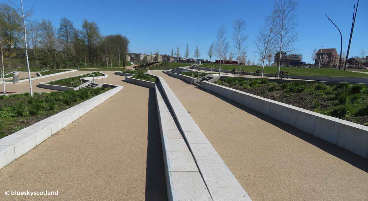
With all the old estate and tower blocks swept away into history it now looks like this and has been rebranded North Bridge. The steps leading up to the actual bridge over the M8 motorway and the new estate. I was here with Anne last year in August 2022 but the bridge was still unfinished then. There is a pram/wheel chair/ bike friendly ramp up here in a gentler serpentine climb to the top.


Now it's complete and very nice it is as well. I don't know if it's the same for everyone but I do get a kick out of exploring brand new urban areas. (i.e. areas that are recently constructed and mint fresh)
It's the same kick of euphoria I get out of blue sky sunny days... to the extent that I don't bother doing walks in dull grey weather as that always lowers my mood. I'm half butterfly! Or bumble bee.... But as soon as the sun is out I am as well.


Loads of white stone blocks sparkling, sculptured sofa sized giant pebbles and newly planted young trees. Also loads of attractive paths snaking through this newly created landscape.


In one direction leading towards Port Dundas and the Monklands Canal, also getting a makeover...


Monklands Canal and Port Dundas....


And in the other direction running over towards Sighthill Cemetery... so plenty of walking potential here to explore...


Which I did. Heading on the new open plan walkway in the direction of Sighthill Cemetery.


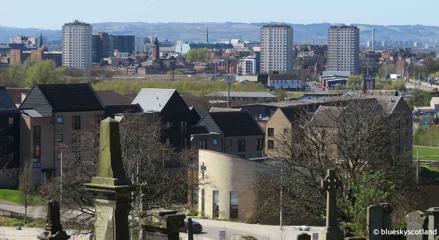
Entering Sighthill Cemetery. As it sits on a hill it offers good views over Glasgow.


City Centre district and bus station showing where I've walked from.


Cowcaddens District and St Rollox Church.


Glasgow's Royal Infirmary and the Sighthill area of North Bridge still to get developed. It is still a work in progress but so far what is here already is worth a visit.


Townhead district from North Bridge Main Stairs.


Outdoor bouldering wall. North Bridge. Only eight foot high at it's highest and around 30 foot in length. Some chalk marks on it already. I was never really into bouldering much, more big mountain rock routes but a nice decorative feature for local children to clamber on.


The stone circle at North Bridge.


New housing being built. North Bridge. Apparently this is currently one of the largest regeneration projects in the UK, outside of London.


More new streets from Sighthill Cemetery.


The new Sighthill Community Campus at North Bridge.


Side view with silver birch trees. This area already has fine new walking routes running through it with more to come. It also looks good for cycling, roller skates or skateboarding due to dozens of brand new flat surfaces although I'd better not mention that. 


A new walkway in North Bridge.


St Rollox Church in Sighthill. All the different crosses are ones found across the globe from  different religious groups. I had no idea so many existed.


The info board on them all. An unexpected and enjoyable walk, especially when you link it with the Sighthill Cemetery walk as well or you could arrive, continue, or depart via the nearby Forth and Clyde Canal at Port Dundas. Where canal goods once arrived in the city from outlying areas.


Wednesday, 26 April 2023

Crookston Castle to Hurlet Hill, Dykebar, then Paisley. An Unexpectedly Good Wild Walk.

                                                   ALL PHOTOS CLICK FULL SCREEN.


Pollok Shopping Centre, above. Silverburn. It was while I was on the roof of Crookston Castle looking out at the surrounding landscape of fields and woods that I realized a walk could be planned by starting at Silverburn, seen above, walking to Househill Park, 5 mins away, then through that to the Hurlet, accessing Faskin Road in Roughmussel then Hurlet Hill, The Bull Wood, Temple Hill, Dykebar Hospital, then Hollybush then Caplethill Road then bus back  from there to Paisley Town Centre. I'm giving precise locations to follow as it was an unexpectedly good long walk through scenic countryside. More importantly most of the walk was new to me which was a real treat as there's hardly an inch on the OS Landranger Glasgow and Surroundings Sheet 64 map I haven't explored at some point in the past. The map I used on this outing however was an AZ Glasgow Hamilton Motherwell Paisley Street Map which had more detail on it.


You can see from this photo how much green land and woods surrounds Pollok even though at its 1970s peak this giant housing estate held almost 60,000 people within the G53 area. Silverburn incidentally was voted the UK's best shopping centre a few years ago and is one of the largest examples of its kind in Britain.


Pollok is also the most diverse of the big four  housing estates on Glasgow's outskirts as the other three of Castlemillk, Easterhouse, and Drumchapel had a later build date in the mid 1950s early 1960s and held mostly streets of tenements with a scattering of high rise flats. Whereas only one low rise tower block  exists in Pollok at Nitshill as it started off as a garden suburb in the 1940s with cottage type houses, most of which remain today, as seen here still in good condition 80 to 90 years later. Few of the older flat roofed tenement clusters in Pollok lasted past the 1990s although some individual sets remain today to give you an idea of what the rest looked like. Just across the road from this set of houses on Barrhead Road stood the Bundy housing scheme of Cowglen Road, Bridgend Road, Dykefoot Drive, Lawside Drive and Fairhill Drive. Despite being a very small estate of five short streets it was fairly notorious and only lasted from the  late 1940s to the mid 1970s before it was knocked down to build the original Pollok Shopping Centre which replaced one row of local shops here until it too was replaced by the current version- Silverburn built 2006/7.


I used the nearby Haughburn Road to enter Househill Park, seen below.


and from here, ten minutes stroll from the shopping centre, it is all green fields, woodland, and grass meadows until you reach Paisley. Although I'd already worked the route out I would take on the map I had no idea it would be this good.


I walked through the park, crossed the stone bridge to the Barrhead Road side of the Levern Water ( this bridge crossing  within the park is important if you don't want to end up on the wrong bank of this stream) then followed this green ribbon of grass past Crookston Road Shops, seen above, to Roughmussel.  A short lane gains entry onto Faskin Road which in turn leads uphill to the path onto Hurlet Hill.


Always been a nice, well kept, small housing estate this. At the top of this road a grass path on left leads up to a trig point.


From this point onwards you are into wild grasslands- farmland- woods. Hurlet Hill  just ahead.

Unusual trig point.


Heading downhill parallel to Hurlet Road I walked through Hurlethill Plantation on the way to the Bull Wood. I did not turn back!


 Looking back at Hurlet Hill and the Bull Wood. This is a large area of meadow , some central marshland, and mixed woodland (the size of Pollok Park) but more open and I think the main reason we only came here once as children/ teenagers was it was very boggy after rain, herds of cows always seemed to be present here churning up the ground and sometimes a frisky bull ran around here as well...., and we had thin soled leaky footwear back then for negotiating this type of terrain.... or for making a fast getaway from anything chasing us....potentially an ankle snapper at running speed (Black gym shoes if I remember correctly.) The child equivalent of high heels today for women...i.e. footwear only suitable on firm flat ground in dry pedestrianized urban areas...(if you stood in a hoof print hole back then it not only unbalanced you and soaked both feet in winter, baked rock hard in summer heat it was very painful to walk over... and made any onward progress across an open field tediously slow and careful)....to curtail our natural curiosity and inert teenage bravado to push any boundaries placed in front of us.... perhaps it was clothing and footwear maybe consciously or unconsciously evolved by our parent's generation as well... or so it could seem looking back now... both to safeguard us and to limit our wanderings... as it still is today if you wear that kind of attire now. For instance...short trousers and flimsy footwear on an under ten year old walking through nettles or brambles is still highly effective today as a barrier to exploration.

 Even without a warm coat, hat, gloves, water bottle, spare food, rucksack, or boots ( which would tend to give the game away to our parents that we didn't always stay put within our own local area) we still managed to reach Kilmarnock in a single day's hike, Barrhead  Neilston and Newton Mearns also got a visit. Not in any bid to run away from home... just exploring our surrounding environment out of natural curiosity. Hunger and a lack of spending money usually enticed us home before it got dark. But that was a full 12 hours of child roaming freedom on Spring/summer weekends.


Apart from a central small marsh which you can easily avoid it was bone dry and I had walking boots on now so it was not a problem. Short grass mostly so even trainers would do here. 


The entire walk reminded me very much of childhood rambles across Parkhouse Road in Nitshill where 20 paces from my old house you would be in dairy cattle farmland similar to this with wide open vistas and easy walking. Skylarks, curlews, robins, thrushes, blackbirds, wrens, and yellowhammers singing all around. That area, the equivalent acreage of five of Glasgow's largest parks combined.. ie Queens Park, Bellahouston Park, Dawsholm Park, Tollcross Park and Linn Park is now lost forever to the owner occupied housing estates of Darnley, Parkhouse, Southpark, and Deaconsgrange above the Jenny Lind. The Dams to Darnley Country Park used to look very similar to this short grass field system layout on both sides of the Corselet Road lane and Brock Burn instead of the overgrown jungle it is today so that's why I know livestock still graze here periodically... otherwise the vegetation would be much longer.


New housing estate around Leverndale and Crookston Road. Even in this area several new housing estates have munched ground that was once open countryside and farms- the equivalent acreage of Bellahouston Park times two. Nowadays, most places I go... if I've not been for a few years or a decade it has usually changed considerably. In the 1970s this was all farmland and fields I remember.   Crookston Castle in the distance, above.


 Luckily, amazingly, much still remains, a large area of open countryside with the bonus being I saw hardly anyone at all for four hours. One lone dog walker in the distance. It was an Easter Saturday, a cracking sunny day, and a public holiday.  If I'd been on Skye or any of the other hill-walking/ tourist hot-spots or even remotest Knoydart it would have been mobbed with people. With long traffic tailbacks going up and especially coming back. Stuck crawling along slower than walking pace at the Loch Lomond to Glasgow bottleneck for an hour or longer, burning expensive fuel in a traffic standstill, like so many trips in the past. Whereas here, on the outskirts of Glasgow, any day of the week, you will likely find a peace and serenity totally missing from most of the Scottish Highlands today, especially during a holiday period.


Spotted a number of different butterflies. Peacock here.


A couple of Roe Deer..... then a kestrel and a fox. It felt a lot like paradise.


Neilston Pad from Temple Hill. I then walked down to the roundabout at Grahamston Road B771 and entered Dykebar Hospital Grounds. 


Some farmland you can tell at a glance is not that accessible...... either too many barbed wires fences, hedges, ditches, livestock or crops in the way but this walk was perfect. No livestock on that day and any fences encountered had a low wire missing or a gate or stile to aid access through it and several grass paths were already obvious from a distance making the normal local route to follow across this terrain fairly straightforward throughout.


The last time I visited  Dykebar Hospital  was on a cycling trip about eight years ago. I was impressed by it then and again today. It reminded me of Quarriers Village, also in Renfrewshire, a former children's home/location now partly preserved with some of it converted into housing stock. Many of the original buildings stay intact and beautiful that way. I feel the same about Dykebar.


This place is partly closed down and may be flattened altogether. I hope not though. The low level white 1960s buildings, not shown here, would be no loss if they disappeared but the older sandstone buildings should be saved if possible and it still has an attractive Capability Brown feel to the surrounding landscaped grounds. Tailor made for upmarket conversion.... I would assume?


Scenic meadows surround the buildings and you can still see where tennis courts, a football pitch and playing fields stood. It would not take much to bring them back again to full use


It does have something of a wonderland feel to it.


And the countryside beyond that point, heading for the stone ruin of Hollybush, was equally good. Green paths to follow here as well... few fences.


Gorse bushes in bloom.


I came out at a metal gate on the outskirts of Paisley near Thornly Park Campus ( which was the scene of a new housing estate just getting built) A handy bus stop was on the other side of Caplethill Road. A signpost to continue further up onto the Brownside Braes was an option from here but I'd had enough excitement for one day as I still had three buses to catch back to my house and further walking to do between them.


Last or first gate depending where you start from. Paisley or Pollok.


Sports grounds and the start of Paisley.


Outskirts of the town of Paisley. A view with small plane landing.


I got a bus into Paisley Town Centre then a bus into Glasgow then another bus back home. Five buses in total but well worth it for such an interesting and varied walk. A Classic.


Wednesday, 19 April 2023

Crookston Castle and Surroundings.


                                                   ALL PHOTOS CLICK FULL SCREEN.


Unlike Edinburgh and Stirling both of which have castles tourists can hardly miss as they dominate any visitor's eye line on entry Glasgow's sole remaining medieval castle sits five miles south west of the city centre in the neighbourhood of Pollok. People can drive right past it without noticing it is there at all and even many Glaswegians are unaware of its existence. Which is a shame because it deserves better.


It may be a ruin half hidden on a small hillside in the middle of a housing estate but it is worth a visit. Whereas both Edinburgh and Stirling Castle charge big bucks to gain entry past the gates Crookston Castle is free and you explore it alone. No crowds unless you are very unlucky. I was there a few days after summer opening times started. April 1st to 30th Sept 9:30am to 5:30 pm daily. Last entry 5:00pm. As usual I had it to myself. You can reach it via bus or train to Crookston Train Station nearby. Indeed the district of Crookston takes it's name from the original owner of the castle and surrounding lands. Croc's town.


A view from the roof of the tower. Coming by car you can park unobtrusively on the quiet minor side street beside the castle, just off Brockburn Road. Leverndale Tower sits astride another modest hill not far away (see last post for that.)


The spring daffodils were out for my arrival and it was a beautiful day. As well as being free having it to myself was a real privilege as it felt even more special wandering around it completely alone. Sir Robert Croc, also referred to as Sir Robert De Croc was a Knight given lands here by the king in the 1100s. He built a wooden fortress surrounded by deep ditches and palisades and the stone castle of today was built on the same spot. The ditches date to the 1100s but the stone castle was constructed early 1400s making it one of the oldest buildings in Glasgow.


Earthwork ditches surrounding the castle.


Like most castles in those uncertain times this one has a single low entrance, easily defended with gate, spear, and swords from within. Unfortunately the 1400 owners, The Darnley Stewarts, backed the wrong side, a common occurrence back then, and the ruin that's left today is the result. The teenage King James the IV attacking it with cannon balls, destroying two of it's four corner towers, holding up the main roof structure. Before that however it was in the possession of one Lord Darnley, who of course went on to marry Mary Queen of Scots, who may well have visited here. 


Main info board here. Darnley and Queen's Park, both districts within Glasgow take their name from events at that time. Battles and courtship. This ruin in fact was probably better appreciated in the 1700s- early 1800s than it is today. A slightly less easy journey on foot, horseback or coach to it being deemed very romantic. Writer Sir Walter Scott and Poet Robert Burns inspired by its location and royal history as back then it would have stood in splendid isolation in undeveloped rural countryside.


The highlight nowadays is the climb up the enclosed tower to the rooftop via a series of steep metal ladders. Edinburgh and Stirling castles might well have more to see inside but neither of them boast a similar airy and fairly intimidating ascent to the rooftop. As I get older it is more of a challenge to climb up to this daunting elevated pedestal and I found the ladders easy enough but didn't move around much once standing on the roof itself. The metal guard rails are fairly low for modern health and safety times and I fancied hanging on to my old age pension now that I've received it at last. Fairly gusty stiff breeze blowing as well up here. A fearless rock climber no more sadly as I avoided looking directly over the edge of the drop this time and stayed well back from the railing whereas before I was happy to lean on it, looking straight down.


Set of stairs to the roof.


The last of several metal ladders leading up to the roof. As it already sits on a hill to begin with the view over Glasgow and Paisley is well worth the climb. 


Leverndale Tower and hospital grounds from the roof of Crookston Castle.


A view over north Pollok  and Glasgow to the Campsie Fells in the distance.


Bellahouston Flats from Crookston Castle.


Lyoncross Road. Pollok. Crookston Wood (on right) and Moss Heights Flats.(in the distance in white.)


The central courtyard and great hall, now roofless. Although still a ruin there's more to see inside than first appearances might suggest.


It was at this point, descending back down again through an eerily empty and silent castle, with the sun directly behind me, that a vile apparition rose into view. I was momentarily discombobulated and had a bit of a shock. A putrid stench arose from the ground under and around me and I knew it had to be an ancient creature once known as 'a selfie.' Undeterred and regaining my shattered composure somewhat I challenged the beast.

" Begone foul imp!" Skunk of Satan!" This is not your rightful home! Leave now at once!"

The sun went behind a cloud and the creature melted away. Cowering under the lash of a human tongue no doubt. (Take note numerous ghost programmes on TV today, paraded as entertainment. Stand your ground and fear no darkness, cold spots, jerky cameras, or mumbo jumbo. Ghost or no ghost.)


From the roof of the castle I also spotted my next destination. A rare jewel indeed. Over many decades I've explored practically every square km on the Landranger OS map Sheet 64 of Greater Glasgow and Surroundings but right here in front of me, a rifle shot from my own childhood home, was a landscape I'd never visited. An unexpected treat.